The Neustädter Talsperre, sometimes also called the “Nordhäuser Talsperre”, is located north-east of Neustadt, in the large wooded area between Neustadt and Breitenstein.
In the 19th century, there were repeated bottlenecks in the drinking water supply for the town of Nordhausen. An expert opinion came to the conclusion that this bottleneck could only be remedied by building a dam in an unpopulated area.
Work began in March 1904 with clearing in the area of the future reservoir. The work on the dam, which impounds the Krebsbach, was mainly carried out by Italian specialists. The material was transported from Neustadt by a field railroad. Despite a temporary shortage of labor and materials, the dam was completed in October 1905.
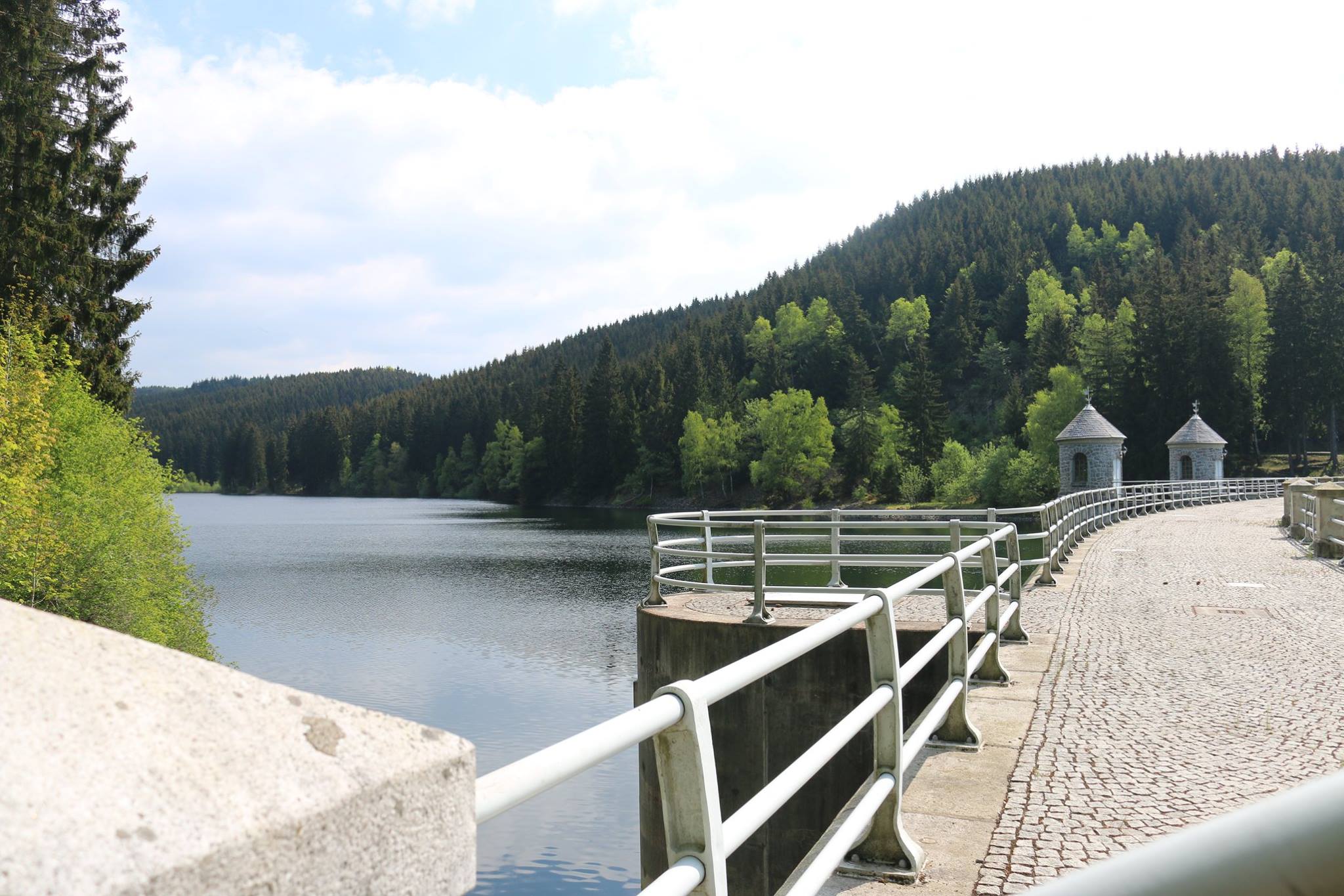
In 1922 and 1923, the dam wall was raised by 6.26 m with concrete and was completely overhauled between 1997 and 2001 in accordance with conservation criteria. Among other things, the two extraction towers were rebuilt true to the original and moved further into the reservoir.
As the stamp box is located at the western end of what is probably the most beautiful dam wall in the Harz, we recommend starting the hike to the dam at the Hohnstein ruins HWN 98. From there, the signposted Path of German Emperors and Kings leads to the dam and also crosses the “Historic Post Road”. The dam wall itself is not accessible, but you can walk around the reservoir on a 3 km hiking trail.
