The Huttal (606 m above sea level) lies on the eastern edge of the Clausthal plateau, between Claustahl-Zellerfeld and the Sperberhaier Dammhaus.
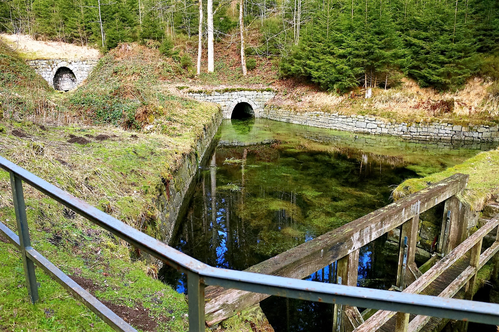
The Huttaler Widerwaage was built between 1763 and 1776 as part of the Upper Harz Water Regal. The structure is able to supply water from the Huttal valley to the Hirschler pond during low water and, conversely, relieve it of excess water during high water.
In the area of the Upper Harz Water Regal, a small basin or a small dam is referred to as an abyss. This basin is dammed up here by a wooden weir structure, a so-called “Fehlschlag”. It is connected to the Hirschler pond on the other side of the ridge by the Huttal watercourse and communicates with it. Water from the Schwarzenberg and the Polsterberg lift house is fed into the weir from the Huttaler Graben. Once the weir is dammed up, the water is passed through the Huttal watercourse to the Hirschler pond. There it could be used to supply power to the very productive Caroline and Dorothea pits.
During high water, the weir’s emergency boards can be removed. The flow gradient is then reversed and water from the Hirschler pond flows through the Huttaler Wasserlauf and through the Huttaler Widerwaage into the Huttal and then on towards the Söse. This has alleviated the flood situation in Clausthal.
The best starting point is the Entensumpf parking lot on the B 242 east of Clausthal-Zellerfeld.
